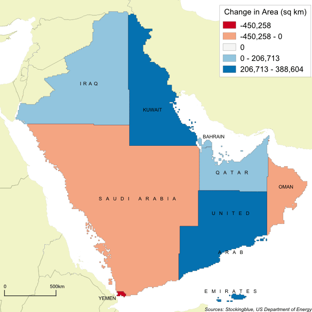
The Arabian Peninsula's Borders Based on Oil Production
Nov 7, 2017

The geographically accurate cartogram above represents the borders of the nations in the region based on oil production. Surprisingly, Saudi Arabia shrinks in size, however, it still remains the largest state in the region.